Contact Lorca Tourist Office on +34 968 441 914
or to send an Email
Click Here


Contact Lorca Tourist Office on +34 968 441 914
or to send an Email
Click Here
To contact Lorca Tourist office please use the secure enquiry form provided below.


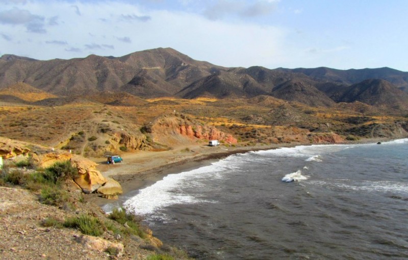
Playa de los Hierros is the one of the series of beaches which lie along the coastline of Lorca and Águilas to the north of the imposing headland of Cabo Cope, and is favoured by the kind of beachgoers who prefer to avoid the crowds and enjoy the Mediterranean in unspoilt surroundings.
The beach is just a couple of hundred metres north of the picturesque cove of Cala Blanca, close to the southern limit of the municipality of Lorca and the boundary with Águlias, and extends over a length of some 380 metres. Behind it are the lower extremities of the foothills of the Loma de Bas mountains, although at this point the gradient is very slight and there is also a track leading through reeds and undergrowth leading to the beach, which is approximately 20 metres wide.

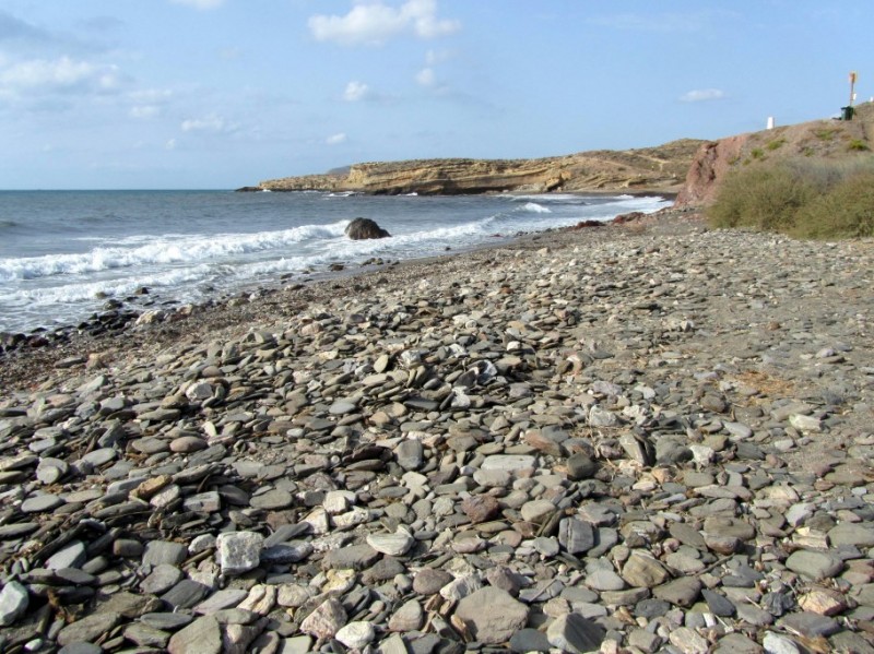
The surface of Playa de los Hierros (sometimes known as Playa El Melarco) is a mixture of stones, thick dark sand and fine pebbles, and due to its exposed nature the waves can become quite rough at times: there are no flags or other warnings when conditions are dangerous, so common sense should be applied at all times!
In the sandstone cliffs behind the beach are a couple of caves which have been hollowed out by a combination of the forces of nature and man’s ingenuity, as is the case at Cala Blanca, and on occasion these caves are used by “wild” beachgoers who typically arrive in motorhomes and opt to prepare food in the natural shelters.

Visitors should be aware that many of those who come to this part of the Lorca coastline often dispense with formalities such as swimwear. This is not an officially designated nudist beach – La Junquera is the only one in the municipality of Lorca – but it is not at all unusual to come across sunbathers chasing that elusive all-over tan, or simply communing with nature without obstructions such as clothing to provide any distraction!
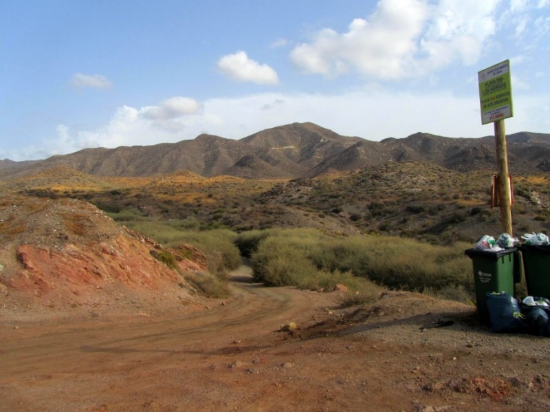
As is almost always the case at unspoilt locations such as this, there are no lifeguards or other services at Playa de los Hierros other than a couple of rubbish bins (all visitors are requested to make use of these, or better still to take litter away with them when they leave, in order to protect the natural environment).
This beach, like others nearby, would most probably have become heavily developed and built up had it not been for the fact that the land behind it is either classified as being for agricultural use or is part of the nature reserve of Marina de Cope area. For these reasons the level of services provided is close to zero, but for those seeking a taste of the “real” Mediterranean this is one of the most important attractions!
How to get to Playa de los Hierros
In theory it is possible to approach the sand in motor vehicles, but drivers anxious to protect their cars will prefer to make their way down on foot from the cliff-top parking area alongside Cala Blanca: sturdy footwear is required, and it is a testing ten-minute walk in the heat of the summer sun.
For those arriving by car the Cala Blanca parking area is the simplest option: from the AP-7 motorway take the exit at kilometre 866 and at first follow the signs along the RM-D14 road towards Calabardina and Águilas. After just over a kilometre there is a petrol station on the left, and at this point a sharp left turn is required onto a narrow but tarmacked track which leads off into the countryside: keep the bar-restaurant at the junction on your right!
After around 1.5 kilometres the road bends round to the left (it is possible at this point to take a rougher track to the right down towards the coast, but the surface is smoother following the road) and leads to the small village of El Cantar. At the entry to the village is a right fork which takes vehicles right down to the coast 2km away: this is officially named the CRS-24-96 track, but unfortunately not all of the signposts are in good repair!
On arrival at the coast there is parking space for a couple of dozen cars next to an abandoned building which stands looking out over the Mediterranean. To the left is the path leading down to Cala Blanca, and this is the route which leads to Playa de los Hierros over the next headland and past another small (and unnamed) cove.

For those seeking a route direct to the beach, the route will take them out of the other side of El Cantar, taking a turn-off to the right where the road curves left, uphill and inland. This track takes vehicles to within a short distance of Playa de los Hierros, but the last 200 metres or so are rather rough and could cause damage fragile suspensions and undercarriages!
It is also possible to reach Playa de los Hierros by boat, of course, and in addition the cliff-top track (part of the GR-92 walking route) is popular among cyclists.
For more local information, visit the home page of Lorca Today.