-


 Welcome To
 PuertoLumbreras


 Welcome To
 PuertoLumbreras


 Welcome To
 PuertoLumbrerasarticle_detail

 Welcome To
 PuertoLumbreras
- Region
- Águilas
- Alhama de Murcia
- Jumilla
- Lorca
- Los Alcázares
- Mazarrón
- San Javier
-
ALL AREAS & TOWNS
- AREAS
- SOUTH WEST
- MAR MENOR
- MURCIA CITY & CENTRAL
- NORTH & NORTH WEST
- TOWNS
- Abanilla
- Abarán
- Aguilas
- Alamillo
- Alcantarilla
- Aledo
- Alhama de Murcia
- Archena
- Balsicas
- Blanca
- Bolnuevo
- Bullas
- Cañadas del Romero
- Cabo de Palos
- Calasparra
- Camping Bolnuevo
- Campo De Ricote
- Camposol
- Canada De La Lena
- Caravaca de la Cruz
- Cartagena
- Cehegin
- Ceuti
- Cieza
- Condado de Alhama
- Corvera
- Costa Cálida
- Cuevas De Almanzora
- Cuevas de Reyllo
- El Carmoli
- El Mojon
- El Molino (Puerto Lumbreras)
- El Pareton / Cantareros
- El Raso
- El Valle Golf Resort
- Fortuna
- Fuente Alamo
- Hacienda del Alamo Golf Resort
- Hacienda Riquelme Golf Resort
- Isla Plana
- Islas Menores & Mar de Cristal
- Jumilla
- La Azohia
- La Charca
- La Manga Club
- La Manga del Mar Menor
- La Pinilla
- La Puebla
- La Torre
- La Torre Golf Resort
- La Unión
- Las Palas
- Las Ramblas
- Las Ramblas Golf
- Las Torres de Cotillas
- Leiva
- Librilla
- Lo Pagan
- Lo Santiago
- Lorca
- Lorquí
- Los Alcázares
- Los Balcones
- Los Belones
- Los Canovas
- Los Nietos
- Los Perez (Tallante)
- Los Urrutias
- Los Ventorrillos
- Mar De Cristal
- Mar Menor
- Mar Menor Golf Resort
- Mazarrón
- Mazarrón Country Club
- Molina de Segura
- Moratalla
- Mula
- Murcia City
- Murcia Property
- Pareton
- Peraleja Golf Resort
- Perin
- Pilar de la Horadada
- Pinar de Campoverde
- Pinoso
- Playa Honda
- Playa Honda / Playa Paraíso
- Pliego
- Portmán
- Pozo Estrecho
- Puerto de Mazarrón
- Puerto Lumbreras
- Puntas De Calnegre
- Region of Murcia
- Ricote
- Roda Golf Resort
- Roldan
- Roldan and Lo Ferro
- San Javier
- San Pedro del Pinatar
- Santiago de la Ribera
- Sierra Espuña
- Sucina
- Tallante
- Terrazas de la Torre Golf Resort
- Torre Pacheco
- Totana
- What's On Weekly Bulletin
- Yecla


- EDITIONS:
 Spanish News Today
 Alicante Today
 Andalucia Today
article_detailA history of Puerto Lumbreras
The story of Puerto Lumbreras is inextricably linked to the Rambla de Nogalte
In one way the municipality of Puerto Lumbreras in the south-west of the Region of Murcia is one of the newest in the Region of Murcia, having been awarded the right to its own Town Hall and council as recently as 1958, but in terms of human civilization it is known that the history of the area goes back at least as far as the Epipaleolithic and the Neolithic, over 10,000 years ago.
Many aspects of the development of the area have been determined over the millennia by the presence of the Rambla de Nogalte, the floodwater channel which now runs through the centre of the town of Puerto Lumbreras. This is due to the existence of an underground water supply beneath the bed of the channel, a natural feature which successive settlers learnt to use in order to make agriculture possible on the plain which lies to the south of the urban centre. At the same time the Rambla also provided a natural communications route between the Guadalentín valley and the kingdom of Granada, via Baza and Guadix.
This location on the main routes of communication between eastern Spain and Andalucía can still be seen today: it is in Puerto Lumbreras that westbound motorists can choose between following the A-7 motorway towards Almería, or taking the A-91 and A-92 inland towards the city of Granada.
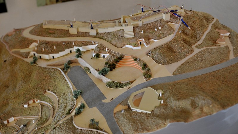
Prehistory in Puerto Lumbreras
Evidence has been found at the archaeological sites of Cueva del Rayo and Llano de Soler of occupation by hominids in the late Stone Age, but it appears that it was not until the Bronze Age and the spread of the Argaric culture between 2200 BC and 1500 BC that the population grew and reached substantial levels. From this period the remains in the area include dwellings both on raised ground near the water courses in Peñas de Béjar and Talancón and on the fertile plain of the Guadalentín and Nogalte in Cañada de Alba: despite its lowland location, this latter site is believed to have been the base for early mining activity in the mountains of the Sierra de Enmedio.
Apart from mining, it is also known that much later in the history of the municipality the inhabitants were involved in the esparto grass industry which was a common feature to many parts of what is now Murcia, as well as generalized agriculture.
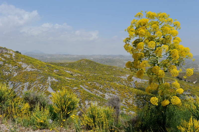
Ancient history in Puerto Lumbreras
After the disappearance of the Argarics, though, it seems that Puerto Lumbreras decreased in importance as an inhabited area under the rule of the Iberians and the Romans, with little evidence of activity between the 5th century BC and the 3rd century AD. This may have been due in part to it being some distance from the main Roman communications route of the Via Augusta which ran along the Murcian coastline and on to Rome as it joined other arterial routes in France, and at this time the farmland of Nogalte was occupied by small holders working on their own relatively small pieces of land. The remains of one such establishment can be seen at the Aljibe de Póveda, where a hoard of coins from the 3rd century AD have been found: these coins can now be seen at the archaeological museum of Lorca.
There is no real evidence of occupation or activity as the Roman Empire disintegrated and the Byzantines, Goths and Visigoths occupied parts of the Murcia Region prior to the occupation of the Moorish Berber tribes which began in 711AD although it is likely that some some of farming continued in the area.
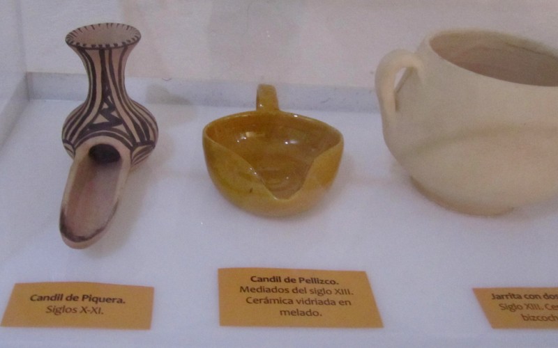
Puerto Lumbreras under the Moors
Again, there is little documentation regarding the centuries during which the south-east of Spain was ruled by the Moors, particularly in the earlier two centuries and much of what we can piece together regarding the development of Puerto Lumbreras between the 8th and the 13th century is based on guesswork and deduction.
However, it has been established that a small farming community grew up around the hill which is known as the Cerro del Castellar, next to the Rambla de Nogalte, and that agriculture made use of the water which flows underground beneath the bed of the floodwater channel: this was the basis of the infrastructure in Puerto Lumbreras which later became known as Caño y Contracaño, and the small wells or “lumbreras” through which the water was extracted are what gave the town its name.
The Moors built a castle or fortress on the hill in the late 12th century in order to protect the local community, and it is thought that this defensive structure was also used by those working the land around the town to store grain and other foodstuffs.
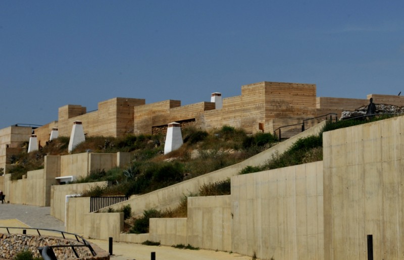
After the Reconquista
Christian forces from northern Spain recaptured the region of Murcia from the Moors in the 1240s, and what is now Puerto Lumbreras became a frontier town close to the border with the last remaining kingdom of Al-Andalus.
The castle passed, logically, into the hands of the Castilian rulers, and was extended and reinforced considerably in order to intimidate the neighbours in the Nazarid kingdom of Granada. The castle’s location above the Rambla de Nogalte made it an ideal vantage point to watch over the frontier, and it shared this role with the castle of Lorca, forming a second line of defence behind the fortresses of Xiquena, Vélez Rubio and Vélez Blanco. It was manned by a permanent garrison which also maintained cattle and agricultural activity, and visual contact was maintained with the fortifications of La Torrecilla and La Hoya.
However, this status as an outpost in dangerous proximity to the enemy, underlined by the Mudéjar rebellion of 1264-66, resulted in a drastic fall in the local population, and in fact even the castle was abandoned in the 14th century.
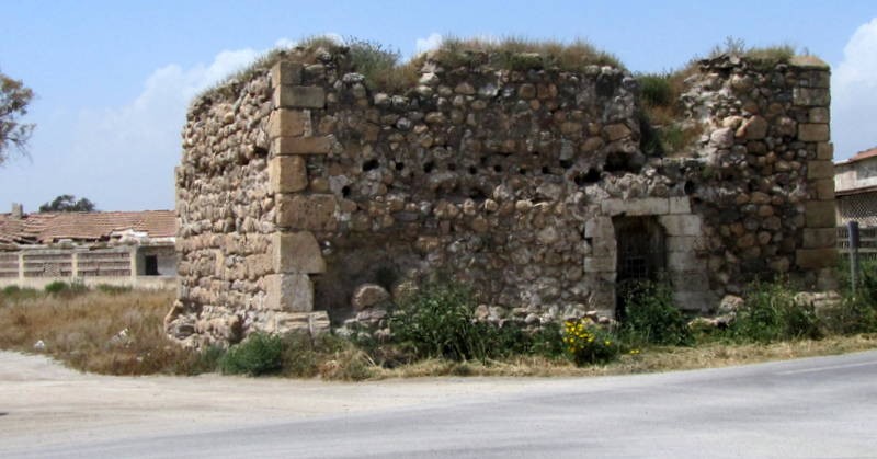
Apart from the frequent Moorish incursions into Lorca and Puerto Lumbreras, the insecurity of the area was made even plainer to see by the conflict between the crowns of Aragón and Castilla: in 1296 Aragón invaded Murcia, although Lorca (including the castle of Nogalte as it had become known) did not surrender until four years later. In 1304, though, a frontier between Castilian and Aragonese possessions was agreed upon along the course of the River Segura, and this resulted in Puerto Lumbreras returning to Castilian rule. But the rapid fall in population can be seen by the fact that in 1338, when King Alfonso XI ordered that repairs be made to the castles of Murcia, no mention is made of Nogalte.
Nonetheless, the strategic importance of the area was undiminished, and it was the venue for many meetings and negotiations between Nazarid and Castilian emissaries. In 1392, though, it was the scene of a rather less diplomatic encounter: at the Battle of Nogalte the administrator of Lorca, Alonso Yañez Fajardo, defeated the troops of Muhammad VII of Granada as they returned with their booty from a raid on the town of Vélez Rubio (in the province of Almería).
The emergence and growth of Puerto Lumbreras
It was not until the 17th century, when much of the land around Puerto Lumbreras passed into the ownership of the Moncada family, that some measure of prosperity reached the area, with agriculture expanding downstream of the Rambla de Nogalte after the installation of the hydraulic infrastructure by which water was taken and distributed from under the ground, as well as from the over-ground run-off channels. The Fuente de los Caños fountain supplied water to the town, which was equipped with a public wash-house and a drinking trough, and a water storage facility was created in order to supply water both for irrigation and for powering the four mills which were located on the stream which is now known, appropriately, as Los Molinos, on the left bank of the Rambla de Nogalte.
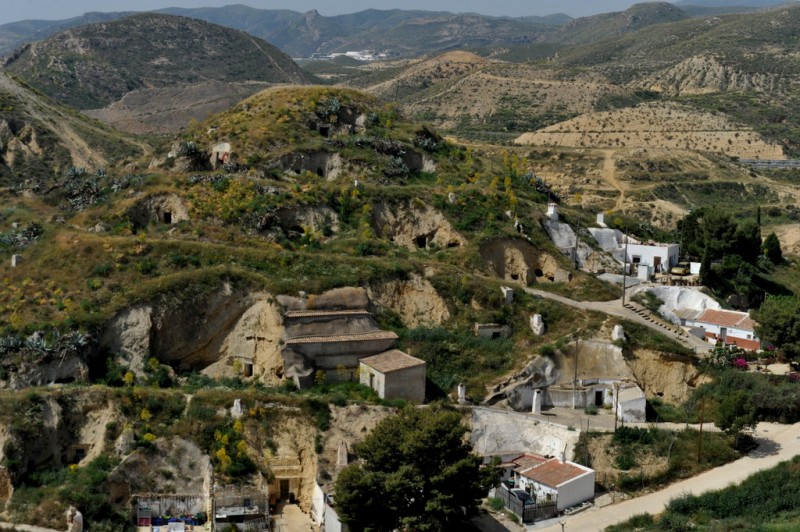
The growth of the town was such that in the early 18th century the church dedicated to Nuestra Señora del Rosario was built, and the population of the urban area grew around the hill on which the remains of the castle stood. Many inhabitants chose to build their homes inside caves on the hillside (some of these can still be visited today) and made their living from cottage industries such as ceramics as well as in agriculture.
However, agriculture was a precarious activity until irrigation infrastructures were in place, and this was followed in the 1870s by the planting of vineyards to meet increased demand for Spanish wine due to the devastation caused in France by the phylloxera pest. In Puerto Lumbreras this led to the deforestation of many areas, and nowadays, with the water supply boosted by the Tajo-Segura irrigation canal, much of the land is used to grow crops such as lettuces, melons and flowers.
The long road to municipality status
In 1812 Puerto Lumbreras came close to achieving independent municipal status as a result of the signing of the Constitution of that year, which specified that all centres of population with over 1,000 inhabitants had the right to do so, but this objective was thwarted when the monarchy was restored just two years later. Further attempts to create a separate municipality failed in the 1820s and 1830s, and then a century later during the Spanish Civil War (1936-39).
Eventually, though, independence from the Town Hall of Lorca was proclaimed on 7th July 1958, at which point the town of Puerto Lumbreras was inhabited by around 8,000 people.
This culminated a period of sustained growth in the town, which early in the 20th century had become the venue for an important annual livestock fair, and since then the population of Puerto Lumbreras has grown to almost 15,000.
Puerto Lumbreras and the Rambla de Nogalte
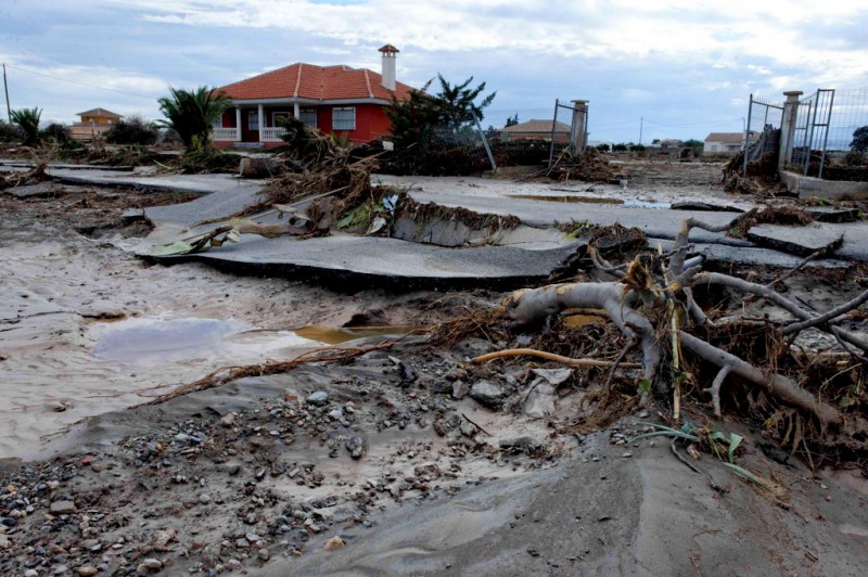
Throughout its history the development of Puerto Lumbreras has been closely linked to the water which is provided by the Rambla de Nogalte, but that flood channel has also been responsible for periodic disasters in the town and the countryside to the south of it. The worst of these was the flooding which occurred on 19th October 1973, when 85 people in the municipality lost their lives and the economic losses amounted to millions, and around 150,000 head of livestock were lost when 13 people died in Lorca, Almería and Puerto Lumbreras during a similar episode of torrential rain in October 2012.
The municipality continues to depend on agriculture as its principal activity, although considerable efforts are being invested into developing other streams of income and industry early in the 21st century, amongst them renewed efforts to create a sustainable tourism industry.
Click for more information about the municipality of Puerto Lumbreras.
article_detail
article_detailContact Murcia Today: Editorial 966 260 896 / Office 968 018 268

To be listed on the CAMPOSOL TODAY MAP please call +34 968 018 268.

To be listed on the CONDADO TODAY MAP please call +34 968 018 268.

Guidelines for submitting articles to Camposol Today
Hello, and thank you for choosing CamposolToday.com to publicise your organisation’s info or event.
Camposol Today is a website set up by Murcia Today specifically for residents of the urbanisation in Southwest Murcia, providing news and information on what’s happening in the local area, which is the largest English-speaking expat area in the Region of Murcia.
When submitting text to be included on Camposol Today, please abide by the following guidelines so we can upload your article as swiftly as possible:
Send an email to editor@camposoltoday.com or contact@murciatoday.com
Attach the information in a Word Document or Google Doc
Include all relevant points, including:
Who is the organisation running the event?
Where is it happening?
When?
How much does it cost?
Is it necessary to book beforehand, or can people just show up on the day?
…but try not to exceed 300 words
Also attach a photo to illustrate your article, no more than 100kb


